
I’m writing this now because I remember years ago desperately searching the interwebs for some kind of written material that would provide more insight on this mysterious and half crazy phenomenon known as “cycling on the Pacific Coast Highway.” I found a couple of sites with good info, but nothing with the sort of detail I wanted. Putting this out there so that the SEO gods may guide it into the browser of whichever new lost soul is seeking answers.
Disclaimer:
Cycling on PCH can be very dangerous. Actually, forget can be. It is dangerous. People die. Often. Take whatever information is helpful from this post but use your own discretion when deciding whether or not it’s worth it. There are plenty of trails and paths throughout Southern California that may suit your needs (more on those later). This post is not meant to be taken as an endorsement of riding on PCH, but rather, a helpful and informative guide.
So let’s begin.
What is PCH?
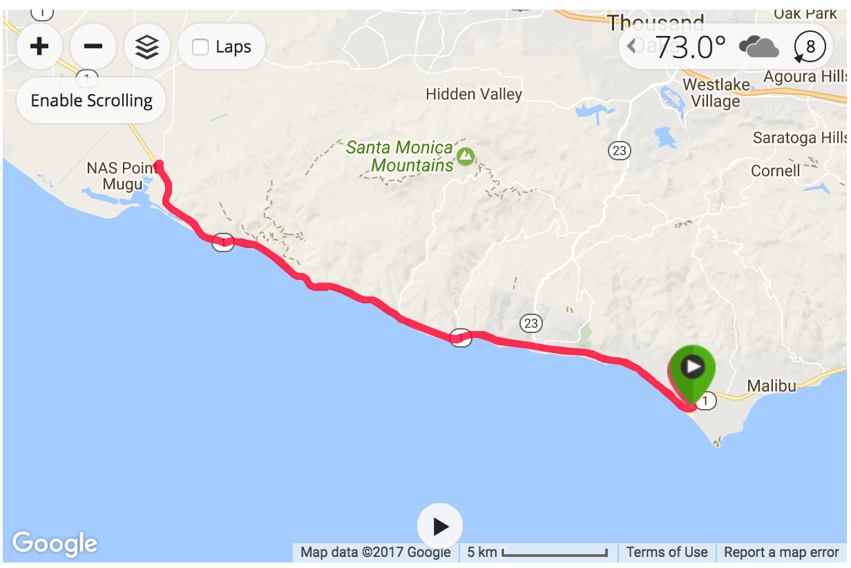
PCH (aka, Pacific Coast Highway, or “The 1”) is a beautiful highway that snakes along the California coast, from Mendocino County the north down through Orange County in the south. The whole thing is about 655 miles but the segment I’ll be discussing is the piece that runs between Santa Monica and Malibu. I have no familiarity with cycling on this route outside of these areas.
Wait, people ride bikes on a highway?
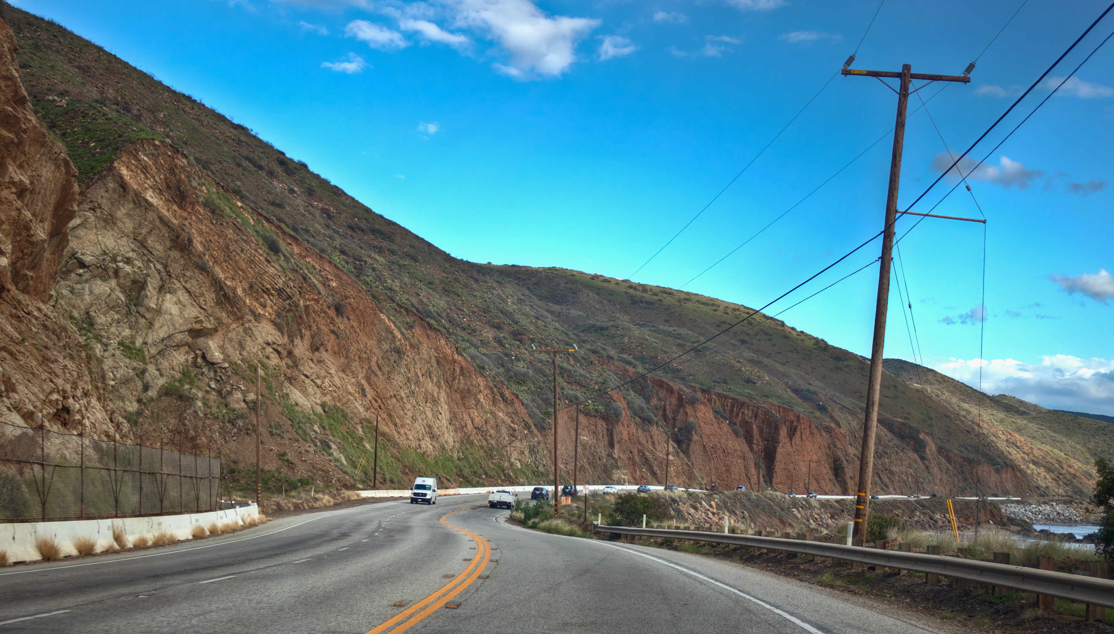
Despite its name, in Santa Monica and Malibu the PCH more resembles a fast moving street. The speed limit ranges from 35 to 55 miles per hour and there are occasional stoplights. In certain narrow patches, cyclists often ride directly on the road alongside cars (more on this later).
Bike riding on PCH is a popular attraction for anyone ranging from hard core cyclists (pelotons!) to triathletes, to simple cross country travelers. Beach cruisers make an occasional attempt but don’t tend to hang around very long.
But it’s still a highway. Why do people do this?
A couple of reasons. First, convenience. PCH is a beautiful strip of well maintained road with exhilarating views of the California coastline. For triathletes, it’s an extremely efficient way to train. You can get your ride in, stow your bike, and then head back out along a nice beach path for a brick run. For cross country cyclists, I would imagine that it’s a likewise efficient point-to-point way to travel with nice scenery.
Also, the PCH is preferable to bike paths often because it’s a much faster route. Beach side bike paths often end up cluttered with pleasure cyclists or tourists bumbling along at low speeds. These routes simply aren’t made for high speeds. Taking sharp corners at 20+ mph on a time trial bike is not only dangerous, but can be foolish and irresponsible when other cyclists are around. By comparison, PCH was designed for cars, with gentle curves and manageable grades, which makes it a perfect training route.
Okay, I might check it out. What else I should know?
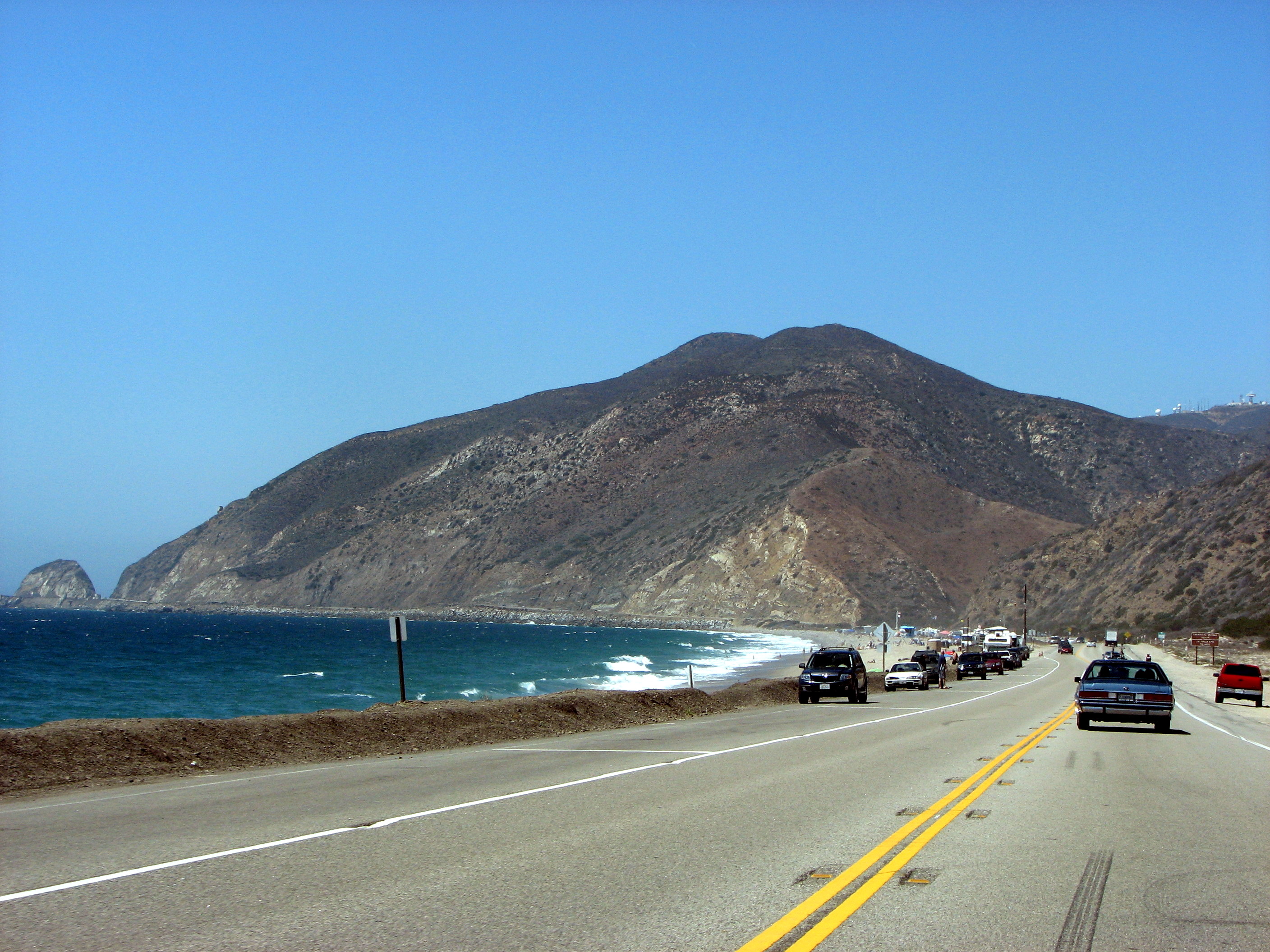
There is no actual bike lane on PCH. Often, cyclists will ride to the right of the highway lane line, which provides a nice wide shoulder for riding. Be on the lookout for rocks, broken glass, nails, etc.
On weekends (and busy summer touristy days) it’s essential to pay attention to the parked cars that occupy the majority of this shoulder side lane. It’s not uncommon to have to pass long chains of parked cars. Watch for pedestrians and opening doors (I can’t emphasize this enough). When cycling, your frame of reference moves more quickly than a pedestrian’s, and they won’t notice you as easily as you’ll notice them (nor will they care).
Also, when passing cars parked on the shoulder, you’ll have to veer into traffic. Do this early to give cars as much time as possible to see you and make adjustments. Don’t wait until you’re right up on a car’s bumper, and don’t bob and weave back in between the cars. Be consistent. When you’re ready to move, check over your shoulder to make sure no cars are immediately approaching, and then stake your claim on the edge of the lane. It’s difficult for drivers to account for how much room a cyclists needs, so don’t make their work any harder.
What about logistics? Parking? Bathrooms?
Depending on where you want to start, there are plenty of places to park. Some brave souls will begin riding in Santa Monica. If that’s your poison, then parking on Temescal Canyon Rd is a good bet (and free), as is the Will Rogers Beach parking lot across the street (not free). There are public beach bathrooms available for the final pitstop before shoving off.
Another word of caution: The PCH route between Santa Monica and Malibu is hellish and only recommended for the seriously brave. Shoulders appear and disappear, cars veer and careen on sloping curves. I’ve never ridden that route and I don’t intend to anytime soon.
Another great place to start is right across from Pepperdine University in Malibu. Park off of Malibu Canyon Rd (there’s a lovely little park) and then ride north. The way will be hilly but good training. There are bathrooms within the little park that are usually unlocked.
Lastly, my favorite place to start is at Zuma Beach. Head north from Santa Monica and turn off following the signs for Westward Beach. Street parking is free at Westward, but paid at Zuma, so choose whichever suits your needs best. There are bathrooms at both beaches, although Zuma’s tend to be cleaner.
As far as facilities beyond those places––there’s a restaurant called Neptune’s Net about 9 miles north of Zuma, as well as a campsite just south of Mulholland Highway. The campsite has bathrooms and even a little convenience shop (it’s a great place to pick up food, water, or uh, bandaids if the occasion calls for it, so be sure to keep a couple dollars tucked in your kit).
North of Mulholland highway, you’ll be on your own, so be sure to get all pit stops out of the way before venturing any further.
What’s a good beginner route?
Start at Zuma, ride as far north as you please, then turn around. Doesn’t get any simpler than that. North of Zuma there are no stoplights, but traffic is usually sparse enough for a quick U-Turn. The farthest I’ve ever gone is the Las Posas exit (you’ll see signs). That’s a handy place to U-Turn and then loop back onto the highway heading south. Once you get more experienced there are plenty of canyons to check out that make for very creative (if not exhausting) riding.
What about emergencies?
This speaks to the general rules of cycling––always pack things like fresh tubes, CO2, extra food, water, cash, etc. In the event of a serious emergency (accident or crash) it’s good to have a phone handy and to ride with identification in case you’re knocked unconscious (not fun to think about, but it does happen). This is also why it’s generally good advice to ride with a group until you learn the ropes. Cycling buddies can keep an eye out for your well being, and vice versa.
In the event that you are cycling alone, just know that PCH becomes fairly barren north of Mulholland highway. Even still, there are often plenty of tourists and motorists who are likely to spot you and call in the proper medical response teams should the need arise. Also a less than comforting thought, but hey it’s true.
Anything else I should know?
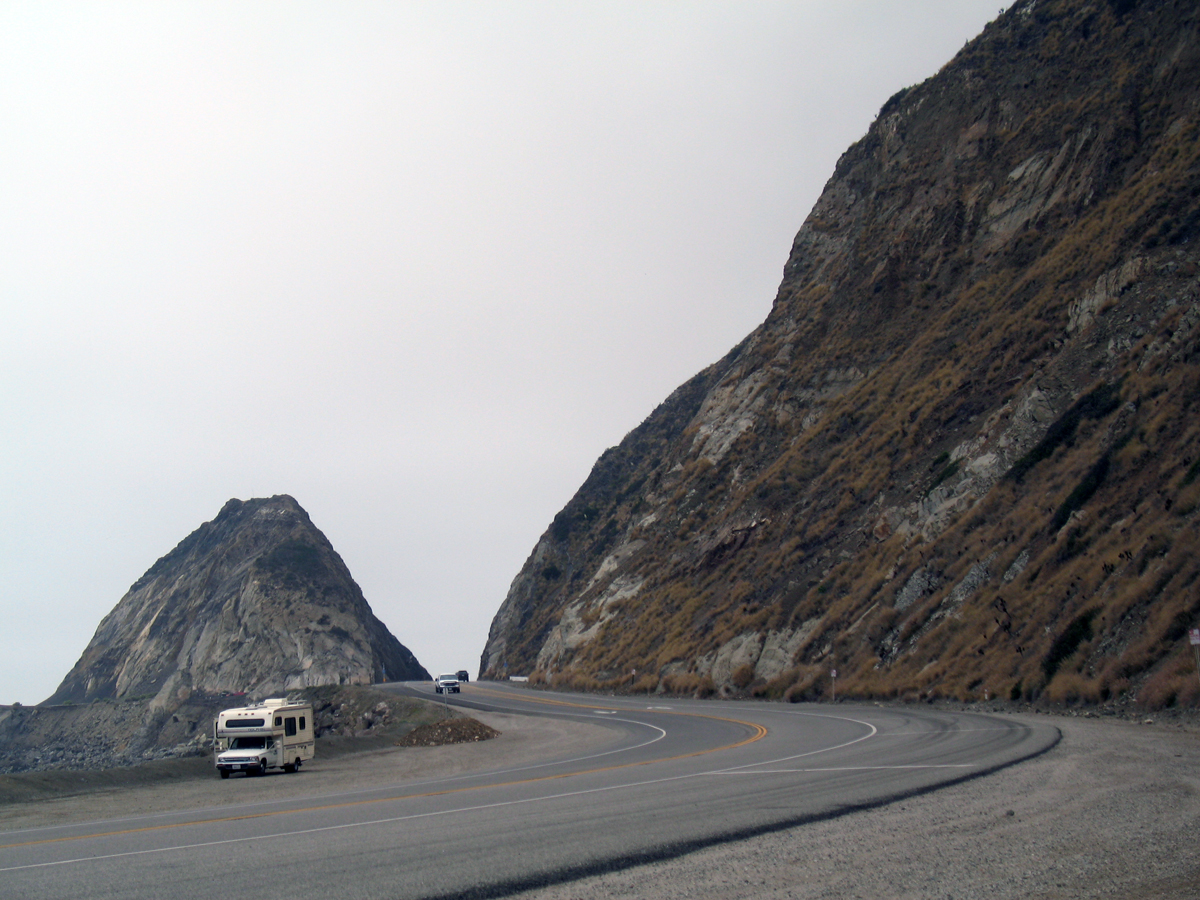
Be sure to stop for a selfie at Big Rock. In case you’re unsure, Big Rock is a big rock about 17 miles north of Zuma. It’s great place to take a break, refuel, and enjoy the view.
(While you’re resting, check out this cool article that describes the history of the formation: https://www.kcet.org/shows/lost-la/when-pch-blasted-through-point-mugu)
Did I miss anything? Leave a comment if there’s something I didn’t cover. Hope this helps!


